
What is a Riparian Buffer/Area?
A riparian area is the area of land adjacent to a stream, lake, or wetland (see diagram below). Most healthy riparian areas have moist, fertile soils that support many types of moisture-loving plants. These plants provide food and shelter to numerous fish and wildlife.
- A Landowner’s Guide to Riparian Areas in Jackson County, Oregon


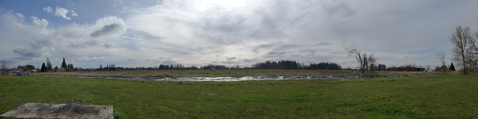
The flags in the pics above mark the outermost perimeter of the overflow riparian buffer zone. The picture below shows the tarping of this area on 4.15.23.
Phase 1
In the winter/spring of 2021-2022, we experienced a heavy and extended annual rainfall which caused extensive flooding in the riparian buffer zone. After marking the flooded overflow areas, we applied for and secured a CREP (Conservation Reserve Enhancement Program) Grant to plant a Riparian Forest Buffer Strip. After reviewing the grant guidelines however, we learned that the use of the recommended herbicides would cause harm to aquatic wildlife and pollute the groundwater.
Specifically, to meet the grants 2-year timeframe multiple sprayings of herbicides would be required to remove the invasive Reed Canarygrass which would in turn threaten the health of existing soft bodied amphibians, insects, birds, microbial soil life and include groundwater and downstream waterway contamination.
And further, because the grant requires that costs be paid out of pocket before reimbursement caps are specified, it comes with a level of financial risk.
To holistically address a sustainable and regenerative solution, we identified a non-herbicide alternative in the form of large, recycled billboard canvasses to tarp the grass and remediate the wetlands.
In April 2023, we tarped the non-native Reed Canarygrass on the eastern side of the creek, an area approximately 686 feet long x 20 feet wide, to prevent the grass from photosynthesizing.
After about 3 to 4 months, the grass, its rhizomes and seeds began to decompose. We will begin phase 2 in the summer of 2024.
During the winter season of 2023/2024, we will begin mapping a landscape design to be implemented in Phase 3.
Phase 2
In Phase 2, we will divide the length (686 feet) of the riparian buffer into 9 equal sections. We will begin removing the billboard materials, working on one section at a time, replacing them with cardboard sheet mulching, compost and bark mulch to create surfaces ready for native wetland tree and shrub plantings.
Phase 3
Following completion of Phase 2, we will plant native wetland trees and shrubs in order to support a multi functional ecosystem of pollinator and bird host plants and provide food for wildlife and humans alike. As these foundational plants begin to grow, they will shade the creek and begin to change the environment preventing the return of reed canarygrass.
Phase 4
The focus of this phase will be planting flowers and ground cover. Once the foundational plantings are completed, we will focus on color and fragrance and on growing flowers that are high in pollen and nectar for honey and mason bees, and butterflies.
Phase 5
Repeat Phases 1 through 4 on the opposite side of the creek incorporating native woodland wildflowers with native wetland trees and shrubs. The width of this area is larger ranging from 35 to 90 feet wide.


Plants in healthy riparian areas:
•Provide wood to streams, creating fish habitat and slowing the stream flow after storms. •Shade streams in the summer. Cool water is healthier for many native fish species. •Help prevent erosion by holding soil in place with their roots. •Filter sediment out of muddy runoff, keeping sediment from smothering fish habitat. •Allow heavy winter rains to soak into the soil instead of running into the stream. This allows water to be released slowly to the stream during the dry season. •Filter out pollutants, such as fertilizers, pesticides, and animal wastes. •Provide important food sources, homes, shelter, and travel corridors for wildlife, fish, and other aquatic organisms.
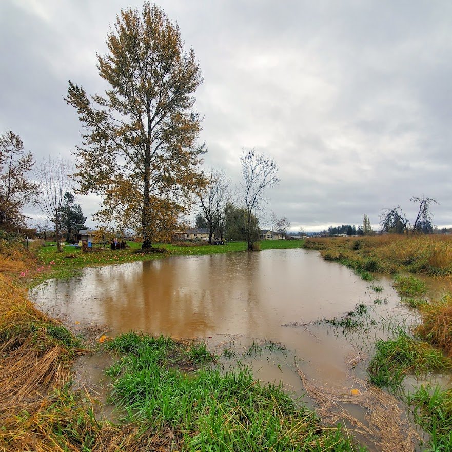
Future Pond?
This photo shows how the creek overflows in the rainy season. The creek curves in this area and creates a naturally formed seasonal pond when we experience heavy rains. Many mallard ducks use this pond during the winter season as habitat.